
:
Staying safe during the outback flooding
This year’s wet season in northern Australia delivered record rainfall and resulted in significant flooding in some areas. With the dry season just around the corner and travellers preparing to head north for winter, we look at how to stay safe on the road.
The wet season falls over the Australian summer (November to April). The tropical north of the country experiences heavy rainfall, high humidity, and tropical cyclones and this year has been no exception.
The dry season usually spans from May to October, which is when travellers from the southern states ‘migrate’ north for the winter to explore the region’s natural wonders and experience its unique landscapes and wildlife.
Dry season temperatures are generally cooler and more comfortable compared to the hot and humid wet season. The skies are often clear, making it an ideal time for outdoor activities such as camping, hiking and wildlife viewing.
Central Australia, including the outback, has a more arid or semi-arid climate with less well-defined wet and dry seasons like the tropical north. Instead, rainfall is generally low and erratic, with some areas experiencing sporadic rain in summer (December to February) and occasional downpours from thunderstorms. The rest of the year tends to be dry.
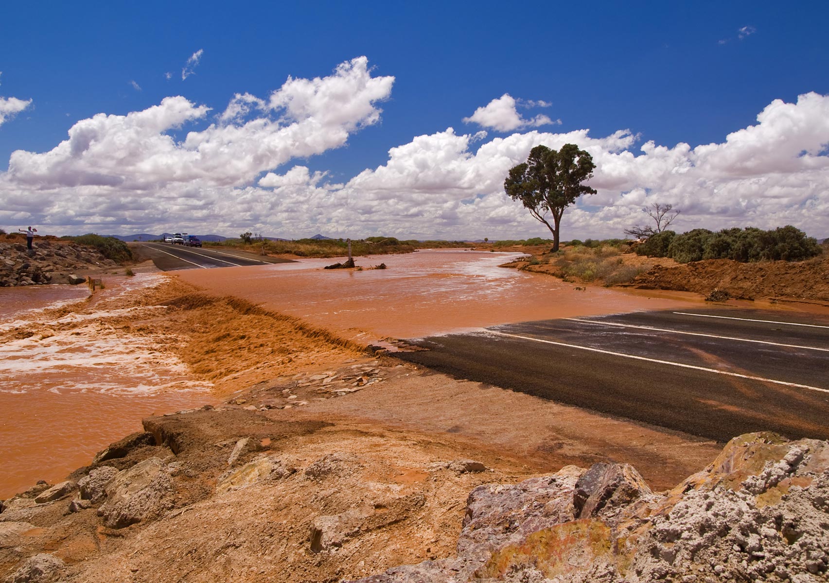
Heavy rainfall during the wet season can lead to flooding, road damage and closures. Unprecedented rainfall in the Kimberley in northern parts of Western Australia in 2023 resulted into significant damage to roads and infrastructure across the region, including the washing away of the bridge at Fitzroy Crossing, which has since been replaced.
Recent flooding
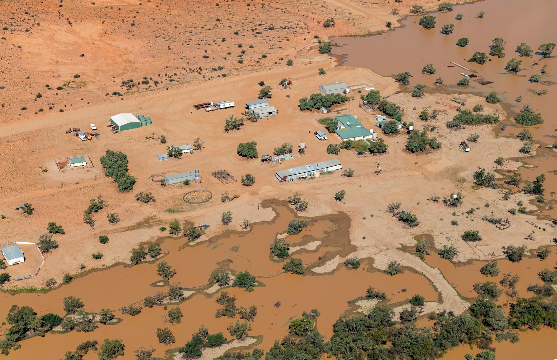
In the lead-up to Easter this year, record-breaking rainfall inundated parts of northern Australia, causing widespread flooding.
It triggered flood watches for more than 40 Queensland and Northern Territory rivers, prolonging a northern wet season which has brought frequent soakings deep into the country’s interior.
Influenced by Ex-Tropical Cyclone Megan, the rain hovered over the Kimberley region, providing moisture to a trough moving through central Australia leading to significant rainfall across the NT, including areas as far south as Alice Springs where the typically dry Todd River received more than 150mm of rain in three days. It was the town’s wettest 72 hours in nine years.
All-time rainfall records were shattered across the outback regions including:
● 444mm at Rabbit Flat (near the WA border), the wettest month on record since 1969
● 200mm at Territory Grape Farm (north of Alice Springs), the wettest March on record since 1987
● 258mm at Arltunga (east of Alice Springs), the wettest month since 1974
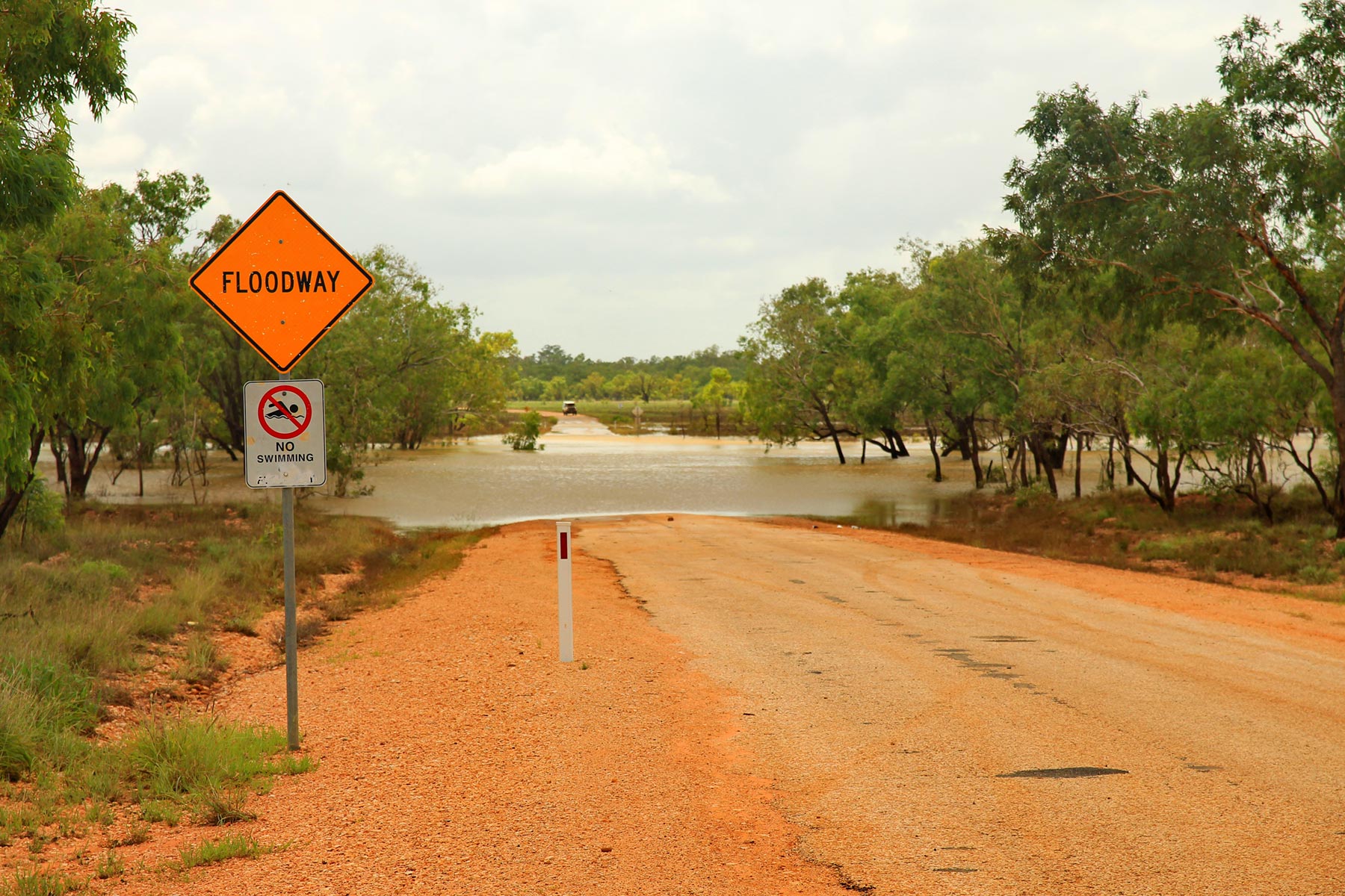
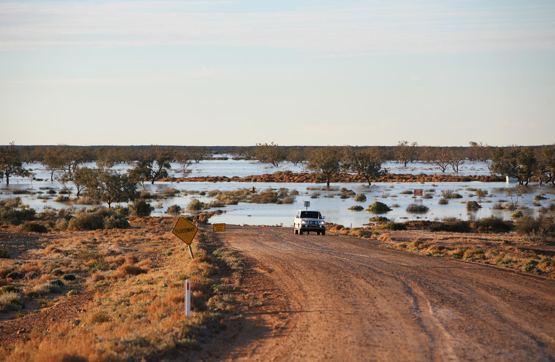
Road conditions
Some roads in the north were severely impacted by recent torrential rainfall and are still not open.
While authorities and local governments typically monitor road conditions throughout the year and issue warnings or advisories, travellers planning to visit Northern Australia, especially remote areas, should do their own homework and check road conditions and the weather forecast before setting off on their journey.
Importantly, be prepared for changing conditions. Make sure you have the appropriate vehicles, supplies and emergency plans in place, especially when traveling in more isolated regions.
Staying informed
There are many ways to get information about closures and other road conditions while you’re travelling.
Local radio stations and news outlets — such as the ABC in rural areas — often broadcast updates on road closures, flood warnings and travel conditions, especially during severe weather events. Tuning in to local radio stations or checking news websites and social media channels can provide timely information.
Local councils in rural areas are often responsible for the maintenance of local roads and their websites and social media pages will have information about road closures, roadworks and alternate routes.
● Shire of Wyndham East Kimberley● Shire of Broome
● Diamantina Shire Council
State Government transport departments or road authorities provide up-to-date information on main roads that fall in their jurisdiction via websites, social media channels, or through dedicated hotlines.
● Qld Traffic
● Main Roads WA
● SA Department of Infrastructure and Transport
● NT Government roads
Smartphone apps
There are several smartphone apps available that provide real-time updates on regular and extreme weather conditions including the Bureau of Meteorology (BOM) and Weatherzone.
The Northen Territory Government has developed its own app for travellers to get real time information about road closures and conditions. The Road Report NT mobile app for both Apple and Android phones can be downloaded from the App store or wherever you get your apps.
Online maps and navigation apps
There have been an alarming number of instances in recent times of travellers becoming lost in the outback because they have used Google or other online applications as navigation tools.
If you are planning to travel into remote areas of Australia, a reliable navigation system such as the Hema HX-2+ GPS Navigator is essential. Leveraging the iconic Hema Maps and remote guidance powered by HemaX Digital, the HX-2+ GPS Navigator includes 150,000 point of interest listings such as camping sites, caravan parks, hotels, motels, rest areas, boat ramps, fuel stops, tourist spots, post offices and more.
Visitor information centres
Visitor information centres in popular destinations may also have information on road closures and travel advisories. If they don’t have the information, they will certainly be able to direct you to the correct source of information. Most visitor information centres have very comprehensive websites for further information.
Road signs and notices
Authorities typically post signage along major highways and roads to alert travellers to closures, detours or other hazards. Paying attention to road signs and notices while traveling can help avoid unexpected delays or disruptions. Entering a road that is marked as closed can incur a steep fine in some states.
Travelers should remain vigilant and flexible when traveling during the wet season in Northern Australia, as road conditions can change rapidly due to weather events. It’s essential to stay informed, heed warnings and advisories from authorities, and adjust travel plans accordingly to ensure safety.
Handy Telephone Numbers
● SA Government: 1300 361 033 (Automated Service)
● Qld Traffic: 13 19 40
● Main Roads WA: 138 138
● Road Report NT: 1800 246 199
See the floods from the air
While flooding often means bad news in the Outback, there are some positives!
Birdsville Aviation - an owned and operated subsidiary of the famous Birdsville Hotel, also owners of the Birdsville Bakery – is currently operating scenic flights over the flooded Diamantina River and its subsidiaries through the Channel Country.
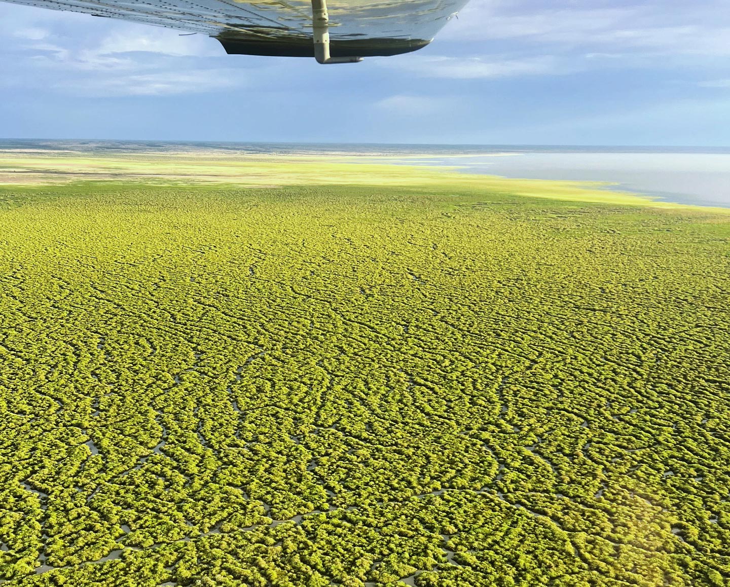
Goyder Lagoon / Channel country
Director Talia Ellis has extensive bush flying experience and has spent the majority of her time in the Birdsville and William Creek regions of Australia.
“Birdsville is perfectly situated to experience the beauty of this as the floodwater revives the vast floodplains surrounding us,” she said.
“The spectacular flood that the Diamantina is experiencing right now is breathing life into everything it touches. The interest for flights over both Goyder Lagoon and Lake Eyre is strong this year and with pilots flying to both of these locations most days,” said Talia.
“They both look spectacular!”
For information about scenic flights head to the Birdsville Aviation website or contact them via phone on 07 4656 3244 or email talia@birdsvillehotel.com.au.
Next steps
At Hema Maps, we strive to provide the most comprehensive and accurate maps and guides for outdoor enthusiasts looking to explore Australia's natural wonders.
Did you find this information useful? If so, please share it with your fellow explorers. Whether it's by SMS, social media, or email, your friends and fellow adventurers will appreciate the valuable tips and insights we've shared.
Let's work together to make the most of every adventure.


0 comments